
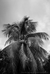
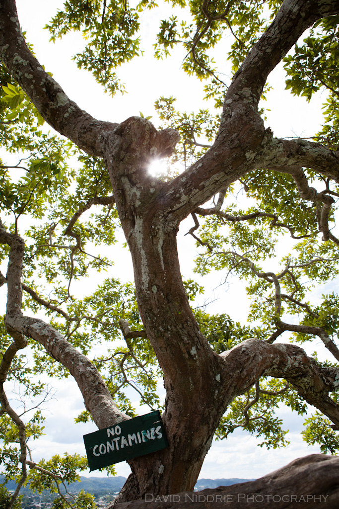
Hang You From The Heavens
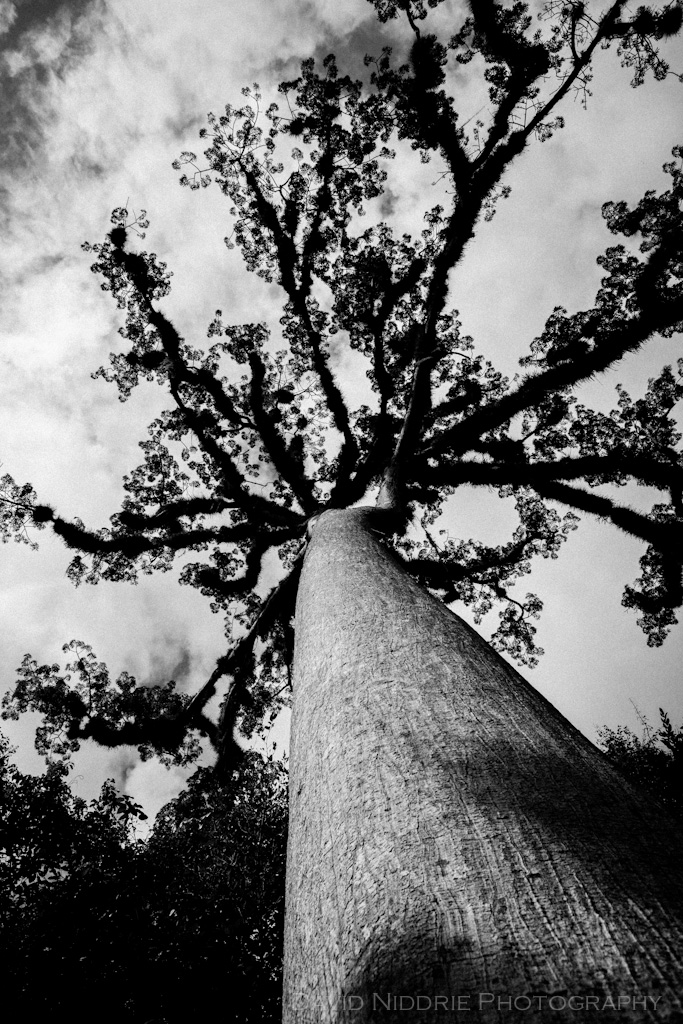
Ceiba tree, El Petén, Guatemala, 2011. Available as an archival, black & white fine art print. Email me!
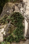
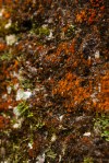
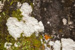
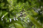
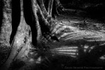
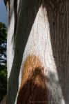
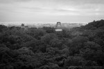
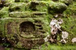
Maya // Tikal Flora & Fauna

Continuing on with the Maya Archaeology series, we’re looking at the abundance of flora and fauna surrounding this impressive site. As mentioned in my last post on Tikal, the magic of this site is in the environment. Sure, the pyramids and temples, altars and sculpture are enough to blow your mind (and they will!), but when you factor in the magnificent setting, deep in the jungle forests of El Petén, it’s easy to become overwhelmed by your senses.
The smell of the earth, somehow similar to a spicy Ichiban noodle scent, and the squish beneath your feet as you trek between structures, pushing vines and giant leaves out of your path. The sounds of the birds, the scurrying of small mammals and the absolutely otherworldly scream of the Howler Monkey giving you a sense of the terror one might get, alone in these parts. The Howlers are the ongoing soundtrack, like an ambient recording you only notice every so often as you drift. Spider Monkeys emerge overhead, their call not as terrifying as their relatives, but enough to get you looking up. And when you do – look out! Nuts, seed , branches, ‘oh please don’t let that be poop’ comes flying down towards you, landing meters from your feet. Are they just having fun with you? Or not-so-subtly saying ‘back off, this is my jungle, man’?
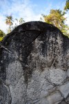
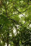
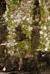
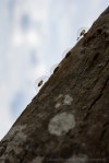
The fifty shades of green are seen in one tropical leaf. Lichen, fungus, ancient bark and wood, carved stone, moss shrouded altars. Those small lumps in the woods – they might be an anthill, they might be an overgrown carving. Ceiba trees somehow find a path to the heavens, shooting directly up from the forest floor. The most impossibly orange bloom awaits in the darkest of shades. Specifically, most everything trod upon here is connected to the greater place that is Tikal.
Tikal, El Petén, Guatemala, 2011.
Previously in this series: Uxmal, Kabah, Kabah II, Labná, Chichén Itzá, Tulum, Tayasal, Tikal


The Dog Days… of Winter
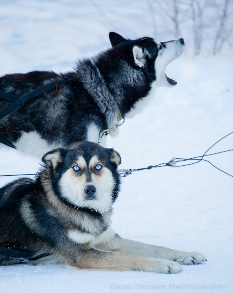
While out snowshoeing in the Spray Lakes region, we came across a pack of sled dogs waiting for their turn to run the course through the trees and along the river constantly ‘mushing’ in the crisp winter air. The ‘pale blue eyes’ Lou Reed sings about might not be on a Siberian Husky, but these eyes will linger on and hold your gaze until the pack gets an inkling to start. Then it’s game over, a cacophony of howls and barks, pawed snow and stretched leash – these beautiful dogs need to run!
Canmore, Alberta.


Coastal
At the edge of the Pacific on BC’s northern Sunshine Coast: Mace Point, Savary Island’s anchor in the Salish Sea.
Snowshoein’ Spray Lakes
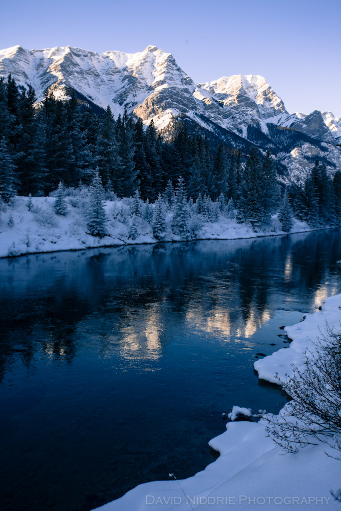
Daytripping into the Spray Lakes region from our home base in Canmore, Alberta – gateway to the Canadian Rockies. A short jaunt up the pass and into the valley behind Ha Ling and Mount Lawrence Grassi yields a bounty of snow-capped peaks on this crisp, clear winter’s day. Can’t get much better than this for a winter wonderland! Back at the road, you’ll find what might be the loneliest phone booth around. Useful for a reservation at the Grizzly Paw I suppose :) Click the first shot below to view large and enjoy!
Spray Lakes, Canmore, Alberta.


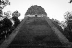
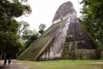
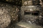
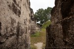
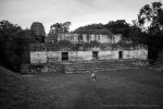
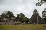
Maya // Tikal
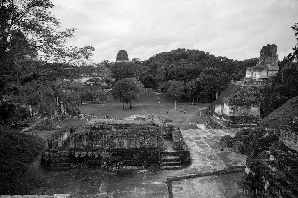
Next stop in my Maya Archaeology series: the grand, Classic-era city state of Tikal. For me this was the holy grail of Mayan sites, a place I had dreamed of visiting since first opening a Mesoamerican archaeology textbook back in the university days. So, yes, a bit of a wait but man, it was well worth it! More than 3000 structures cover about 16 square kilometers of land and in it’s heyday, Tikal was the most powerful Mayan kingdom in Mesoamerica. Monumental architecture dates from 400BC while evidence of agriculture on this site dates back to 1000BC – that’s about 3000 years of history in this part of the jungle! Tikal reached a pinnacle during the Classic Period of 200-900AD with 90,000 inhabitants and remained in use until the late 10th century. This was an important ceremonial, political and dynastic powerhouse with both friends and enemies – Teotihuacán in the Valley of Mexico (Mexico City), Copán (in Honduras), Calakmul and Caracol. Tikal’s influence can be felt throughout the region into Belize, Honduras and up to Mexico.
Our experience at Tikal began with a 3:45am alarm call in Flores. Shortly thereafter, we were on a bus with other weary travelers, making our way north before sunrise. After an hour or so we got to Tikal National Park gates, still closed at 5:30am. We were given a little tip by some friends in Flores. When the bus assistant comes around to collect your park entrance fee, instead of handing him your quetzales, get off the bus and buy your own ticket, ensuring the higher fee you pay as a foreigner goes back into the National Park. It was a little sketchy as they didn’t want us to buy our own, but it felt good knowing we had a receipt, paper ticket and official stamp from the gate. No one else on our bus received anything in return and in hindsight were upset about where their money may have gone. We were told poaching is a major problem in the Tikal, and park fees allowed rangers more patrol time and environmental protection.
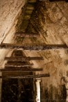
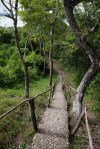
We were inside the park at 6am, rushing through the parking lot to meet our guide and get cracking to the Temples for a sunrise vista. Well, the sun came up at 6am, so we missed that (pro tip: stay the night inside the park at a bungalow and you’ll be there for actual sunrise, atop a temple). However, the first climb up Templo IV as the mist lifts, the monkeys howl and the birds sing was simply amazing. Emotionally charged by the energy, the sense of history, the beautiful architecture — time stood still for us up there. At 70m, this is currently the tallest pre-Columbian structure in the Americas. From here we followed our guide back into the dense foliage. One of the cool factors of Tikal is the rich environment – the site rests in deep jungle, paths between structures are tight, dark and alive and sometimes a walk between temples reveals secrets. After all, almost everything you walk upon here has something of interest below the soil – unexcavated perhaps, but there, covered in jungle flora.
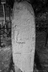
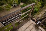
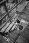
After almost losing our group completely in the vines (a good ten minutes of true panic!) we caught up and made it to the awe-inspiring, 57-metre tall Templo V. Officially closed to climbers, we were ‘special’, so allowed up the extremely steep, rickety wooden ladders. Ok then. Going up wasn’t bad, the view was astounding once again – taking in the tops of the Gran Plaza structures and temples. Going down — yikes. Nerve wracking, what with my sweaty hands (humidity 100%!) and cameras slung across my body. You can see the steep descent in the pics below (“Bajar – Way Down”). A walk to the Gran Plaza, Acropolis, altars, stellae and more collected in one giant main gathering place. After the four hour tour, we left our group here and spent the next five hours exploring the periphery. Spotted a toucan, numerous monkeys, stunning butterflies, hard working cutter ants and little furry mammals.
A few notes gleaned from our guide’s tales: the site was re-discovered in mid-1800s by someone at the Wrigley company, in the area looking for gum trees for their Chiclets they built an airstrip and stumbled upon the overgrown site (true?). The stairs up many of the temples are very high, allowing only the taller royals to physically ascend. Temples are built upon temples and on and on. All for the little room atop, with many having no inner rooms at all. The structures of the Gran Plaza form the shape of the Ursa Major (Big Dipper) constellation when seen from above and are aligned for the solstice as an agricultural calendar. Templo IV features in the original Star Wars as the moon base Yavin 4. Jaguar are regularly seen amongst the ruins. One can devote a life to interpreting this place.
I’ll follow this post with some detailed images – textures, flora and fauna. I can safely say, experiencing Tikal is a highlight of any of my life’s travels so far. I would love a week here to explore further, sit and meditate and absorb some of the ancient energy and knowledge from the great Maya people. In this series, we’ll take a look at another fine site in Guatemala before heading into Honduras for the Copán experience.
Tikal, El Petén, Guatemala, 2011.
Previously in this series: Uxmal, Kabah, Labná, Chichén Itzá, Tulum, Tayasal


A Walk on the Beach

An afternoon on the west coast, walking from Spanish Banks along Acadia to Wreck Beach, Vancouver, 2013.


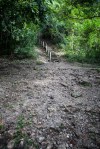
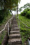
Maya // Tayasal
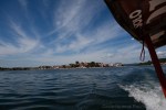
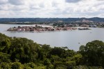
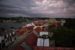
Time for another stop in the Mayan Ruins series and we’re crossing the border now into Guatemala – El Petén to be specific. This is the sparsely populated, jungle laden northern department in the country. It takes some time to get here by land but with a paved road all the way to the island city of Flores, it’s not a bad trip at all. We took an overnight bus from Guatemala City, arriving just before dawn’s first light. The city of Flores itself is incredibly charming. It’s tiny enough to walk around in an hour, and very colourful, almost Mediterranean with the architecture stepping down the hills to lake level. There is a church right on the high point, in the middle of town, that provides a seemingly non-stop fireworks spectacle, well into the night and first thing in the morning. When you are rising at 4am to get to Tikal the next day, it makes for an unsettled sleep.
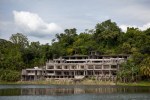
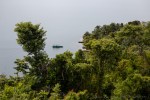
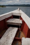
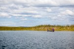
Our first stop, however, wasn’t Tikal. We were working up to that, the big one in my books. For our first day in town we chose to hire a lancha and our new friend Miguel took us out onto Lago Petén Itzá for some sightseeing. Warm waters, warm air…it’s really hot up in here! Our destination was across the lake, to a largely unexcavated Mayan archaeology site called Tayasal. Along the way we passed another “ruin”, a hotel complex said to be abandoned after a particularly nasty storm.
A little further along and we pulled up on shore. Ants! Watching cutter ants hard at work was fascinating and meditative. The woods are so full of life, you begin to realize almost everything is moving if you stop and look. A short walk through the jungle and we come to a clearing. In sharp contrast to the excavated, restored and manicured sites we’d seen in Mexico, Tayasal in distinctly primitive. If not for the sign, we may have missed the fact we were climbing a crumbling, plant covered pyramid. And that’s what we did, up the stairs to a lookout and a platform in an old ceiba tree. The view is excellent, you can see all of Flores and really understand how perfect this place was as a defensive city of the Itza Maya people. It’s said these people were so protected by this island fortress, thick jungle and remote location, it took until 1697 for the Spanish to conquer them, some 150 years after most other Mayan cities had been taken. It’s also a point of debate about where the true “Tayasal” centre was located. Here, or within what is now Flores, or both? Possibly on Lake Yaxha further afield. It’s not quite clear.
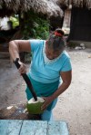
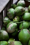
Once at the top, however, there is nowhere left to go but back down. More interesting insects to check out, cocooned prey or a new lifeform hatching? Tayasal has been excavated here and there since the 1920s and numerous ceramics, burials and panels have been uncovered. None are visible here, now. Back on the boat, we went around the peninsula to the other side for some fresh coconut and a swim in the lake. As the day grew long, it was time to return to Flores and watch the epic jungle sunset from the hostel rooftop. Not a bad day, and our first taste of pre-Columbian living in El Petén. Of course, this was just a warmup for the mighty Tikal, up next!
Flores, Lago Petén Itzá, Guatemala, 2011.


Previously: Uxmal, Kabah, Labná, Chichén Itzá, Tulum.
Land of the Woods – Autumn

Autumn in the Land of the Woods. Our garden is still delivering kale and some fresh herbs, but has mostly run its course for the season. Quite the transformation from June, July and into August — now the air is cool and damp, the spiders have packed up and moved on, the birds are working to get every last morsel of seed from the feeders and the soil soaks up the rains for next year. We learned many lessons with our little garden and next year we’re stepping up production and cultivating only ‘winners’. The big bad squirrels that stole many of our squash…well, we’ll have to find a way to interrupt their food chain. A few more rakes of the yard, some pinching, some pruning, ’til we plant again…
Vancouver, 2013.


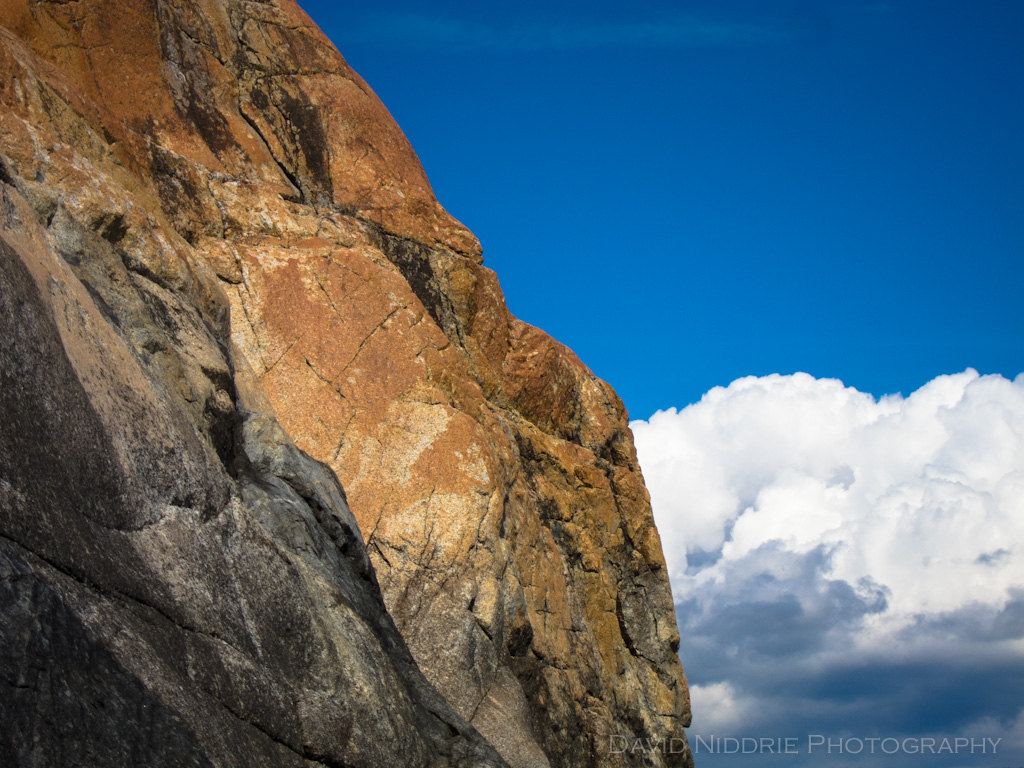
Convergence

Clack Creek at Cliff Gilker, BC, 2013.


