
Maya // Tayasal
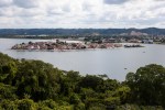
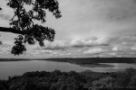
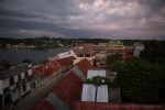
Time for another stop in the Mayan Ruins series and we’re crossing the border now into Guatemala – El Petén to be specific. This is the sparsely populated, jungle laden northern department in the country. It takes some time to get here by land but with a paved road all the way to the island city of Flores, it’s not a bad trip at all. We took an overnight bus from Guatemala City, arriving just before dawn’s first light. The city of Flores itself is incredibly charming. It’s tiny enough to walk around in an hour, and very colourful, almost Mediterranean with the architecture stepping down the hills to lake level. There is a church right on the high point, in the middle of town, that provides a seemingly non-stop fireworks spectacle, well into the night and first thing in the morning. When you are rising at 4am to get to Tikal the next day, it makes for an unsettled sleep.
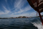
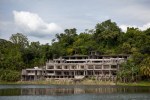
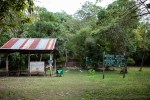
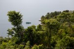
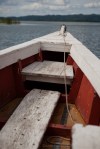
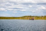
Our first stop, however, wasn’t Tikal. We were working up to that, the big one in my books. For our first day in town we chose to hire a lancha and our new friend Miguel took us out onto Lago Petén Itzá for some sightseeing. Warm waters, warm air…it’s really hot up in here! Our destination was across the lake, to a largely unexcavated Mayan archaeology site called Tayasal. Along the way we passed another “ruin”, a hotel complex said to be abandoned after a particularly nasty storm.
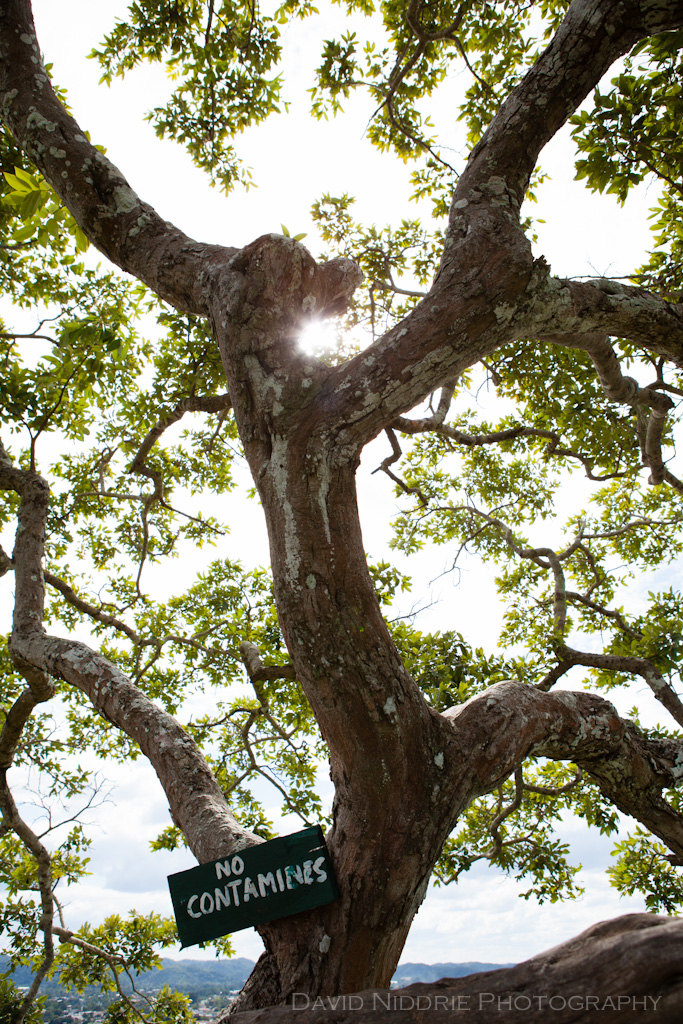
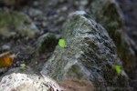
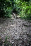
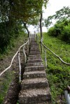
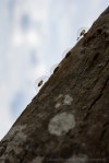
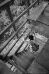
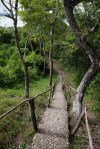
A little further along and we pulled up on shore. Ants! Watching cutter ants hard at work was fascinating and meditative. The woods are so full of life, you begin to realize almost everything is moving if you stop and look. A short walk through the jungle and we come to a clearing. In sharp contrast to the excavated, restored and manicured sites we’d seen in Mexico, Tayasal in distinctly primitive. If not for the sign, we may have missed the fact we were climbing a crumbling, plant covered pyramid. And that’s what we did, up the stairs to a lookout and a platform in an old ceiba tree. The view is excellent, you can see all of Flores and really understand how perfect this place was as a defensive city of the Itza Maya people. It’s said these people were so protected by this island fortress, thick jungle and remote location, it took until 1697 for the Spanish to conquer them, some 150 years after most other Mayan cities had been taken. It’s also a point of debate about where the true “Tayasal” centre was located. Here, or within what is now Flores, or both? Possibly on Lake Yaxha further afield. It’s not quite clear.
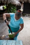
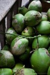
Once at the top, however, there is nowhere left to go but back down. More interesting insects to check out, cocooned prey or a new lifeform hatching? Tayasal has been excavated here and there since the 1920s and numerous ceramics, burials and panels have been uncovered. None are visible here, now. Back on the boat, we went around the peninsula to the other side for some fresh coconut and a swim in the lake. As the day grew long, it was time to return to Flores and watch the epic jungle sunset from the hostel rooftop. Not a bad day, and our first taste of pre-Columbian living in El Petén. Of course, this was just a warmup for the mighty Tikal, up next!
Flores, Lago Petén Itzá, Guatemala, 2011.


Previously: Uxmal, Kabah, Labná, Chichén Itzá, Tulum.
Discover more from Meeting Fires Creative
Subscribe to get the latest posts sent to your email.


VERY NICE:))
SINCERELY ANDREA:))
Pingback: Maya // Tikal | David Niddrie Photography .:blog:.
Pingback: Maya // Tikal Flora & Fauna | David Niddrie Photography .:blog:.
Pingback: Maya // Quiriguá | David Niddrie Photography .:blog:.
Pingback: Maya // Copán | David Niddrie Photography .:blog:.